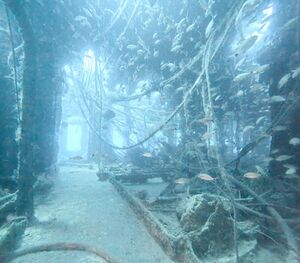
USS Aeolus
From Dive Atlas
| Site Info | |
|---|---|
| Type | Ocean |
| Coordinates | 34.278083, -76.644317 |
| Region | US Atlantic coast |
| Access | Boat |
| Depth range | 90-110 ft |
"Ocean" is not in the list (Cavern, Cave, Wreck, Lake, Reef, Cove, Inlet) of allowed values for the "Has site type" property.
USS Aeolus is an offshore shipwreck in the Atlantic off the coast of NC in the United States. At the end of its life it was a cable laying ship before being sunk as an artificial reef.

Details

Depth
90-110ft.
Topography
Conditions
Visibility typically between 40-70 ft. Summer temperatures typically between 75-80 degrees.[1]
Access
Couple hour boat ride out of Beaufort, NC.
Do
The deck section of the stern has a bunch of swim throughs. Be wary as there are cables and jagged metal in sections.
See
Life
Sharks, grouper.
Safety
Hazards
- Jagged metal
- Loose cables in the wreck interior
- Currents
Equipment
- Primary light if penetrating the wreck
- Cutting device
Media
Nearby
References